While Drone Photogrammetry has become popular for creating 3D models of buildings and elevation models of bare land, its main pull is its accessibility. This can be attributed to the improved features, convenience, and the relatively economical price points of commercial drones such as the DJI Mavic 2 Pro or even the smaller DJI Mavic Air 2S. Further, we now have a plethora of choices in terms of Structure from Motion (SfM) photogrammetry software. Thus, a question that we frequently get is – why do we still need LIDAR?
LIDAR or Light Detection and Ranging is an active sensor. This means it uses its own energy for its main function, i.e., get distances between the sensor and an object. A common analogy is that it is like a flashlight – when you turn it on, you’ll see features previously hidden in the dark. Compare this to an optical sensor – a camera mounted on a drone. For you to have a good discernable image, your environment needs to have the proper amount of light. Thus, in this sense, a camera is a passive sensor. This definition between an active sensor and a passive sensor leads to the several advantages of LIDAR over SfM Photogrammetry. The following section discusses four of them.
1. LIDAR can penetrate between MOST vegetation. Especially with multiple return LIDAR systems, you still get points underneath typical tree canopies or between grass. Note the caveat as in some thick forests where even sunlight does not touch the ground, LIDAR may not suffice. But when it does go through, this is especially important in uncovering features such as creeks and tributaries covered by foliage.
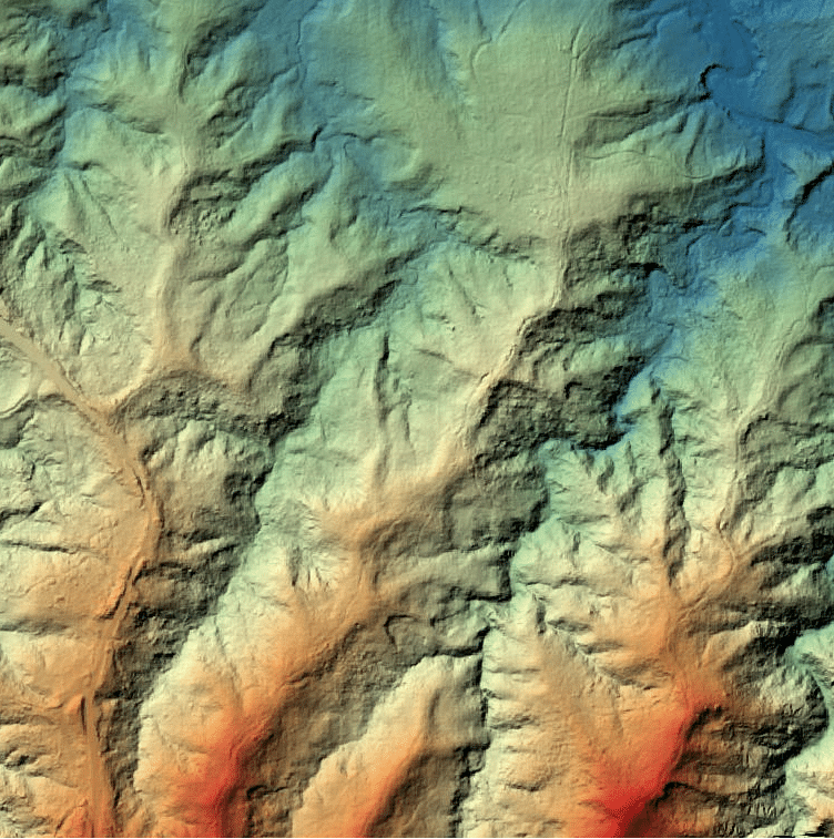
This advantage is illustrated by the figure below. A Digital Surface Model (DSM) is an elevation model that shows features, both natural and man-made. This may include trees, rooftops, and at times, even powerlines. On the other hand, a Digital Terrain Model (DTM) is produced by filtering out everything above ground. Thus, it is also called a bare-earth model.

2. Less computational power required. We’ve had projects covering hundreds of hectares where we did both imagery and LIDAR. LIDAR processing was completed on an off-the-shelf laptop in a couple of days. Imagery processing required a workstation with a top-of-the-line graphic card (or two), large RAM, and a sizeable SSD running twice the time for LIDAR.
3. Operating in non-ideal lighting environments, e.g., dark clouds, is not an issue with LIDAR. Being an active sensor, the amount of point cloud data gathered and its quality are seldom affected by the lighting conditions. This is crucial for tight project timetables or airspace where limited flight operations are allowed. This may even mean flying the LIDAR at night is technically possible, though safety regulations must be followed.
4. Accuracy. For a land development project during feasibility stage, a photogrammetry-derived surface model may be enough for rough estimates. However, on the planning stage and detailed engineering phase where accuracy may mean a substantial change in budget and operational requirements, LIDAR systems can deliver. This is especially true with modern LIDAR systems that can provide sub-decimeter accuracies.
As with our drive of providing fit-for-purpose solutions, the choice between LIDAR or Drone Photogrammetry really depends on the project requirements. Example, an open-pit mining operation may only need the latter. But if it is an exploration area that is like a typical jungle, then LIDAR is the best tool for the job.
At DATUM, we ensure that only proper methods and technologies will be employed for your project. For inquiries, you may send us an email at info@datum.ph or fill-up this form.
